Page Contents
Gloucestershire is an idyllic area of southwest England, perfect for solo hikers. The county encompasses part of the Cotswold Hills and Severn valley, plus the Forest of Dean, meaning that Gloucestershire is a true representation of the great English countryside. Discover your pace and hone your solo hiking skills here in the rolling hills.
Why hike solo as a woman? For the very simple, and fundamental reason that if you’re waiting for someone else to do it, you might never get it done! I started off small by going out to dinner and to the cinema by myself, before graduating to solo hiking, and then to solo travel. Doing things by yourself seems scary initially, but on the other side of fear is a profound sense of freedom. The world opens up to you and you’ll soon discover just how much there is to explore and get excited about out there.
Ready to go? Then start off by exploring Gloucestershire using my handy guide below…
North
The North of Gloucestershire is a sweep of rolling hills, Cotswold beauty and it’s home to the highest point in the Cotswolds. This gorgeous area of the UK is a hiker’s paradise, with walks and hikes to suit all abilities. To discover my recommended starting points for planning your routes keep on reading!
Cleeve Common
OS Explorer Map: OL45 The Cotswolds / OL179 Gloucester, Cheltenham & Stroud
Terrain: Open common
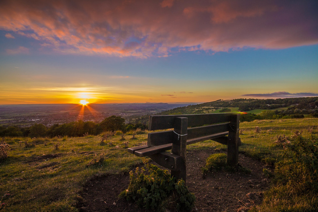
This spectacular common is in fact the largest common in the Cotswolds Area of Outstanding Natural Beauty (which is a mouthful, but gets its point across). Essentially, what that means is that it qualifies as a Cool Place to Hike. Not only is it the highest point of the Cotswolds, at a height of 330m, Cleeve Common is a site of special scientific interest and a conservation area.
With wide open spaces, breath-taking views and over 1,000 acres to explore, I’m sure that, like me, you can’t wait to get going! From views of Cheltenham to the south-west, to the vale of Evesham and the Malverns, I’m told that on a clear day you can see as far as the black mountains in Wales.
If history is up your alley, then the common has 35 iron age hill forts for you to discover, alongside other points of historical interest. I love both solo hiking and history, and if you’re by yourself then you can dally as long as you want, without boring other people! Alternatively, find yourself a history buff or landscape photographer friend to keep you company.
AWW Tip: There are a handful of car parks to choose from, or take the bus from Cheltenham to Southam, Gloucestershire to begin your hike in the west of the common.
East
With a border overlooking Oxfordshire, this part of Gloucestershire is home to the classic Cotswold villages you’ve seen. If photography is up your alley then head to these gems, preferably on a weekday to beat the inevitable crowds of tourists that come in their coachloads.
Bourton-on-the-Water
OS Explorer Map: OL45 The Cotswolds
Terrain: Countryside
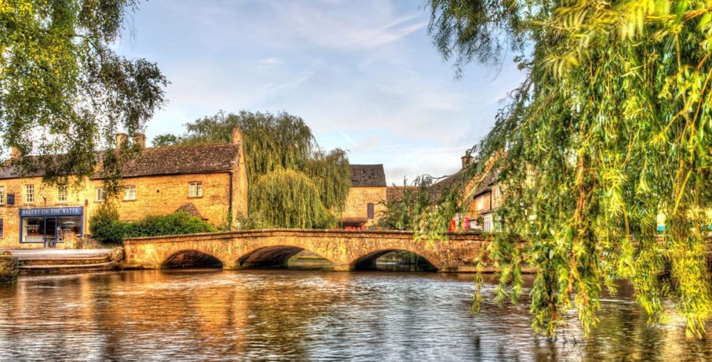
If you’re here for sightseeing and the beauty of the Cotswolds villages, then Bourton-on-the-water is the place to start. While the village itself draws in hordes of tourists, in the surrounding area you’ll find plenty of National Trails, including the Warden’s Way and the Diamond Way.
The Wardens Way links the Oxfordshire Way at Bourton-on-the-Water to the Cotswold Way National Trail at Winchcombe. You can pick up other trails here, such as the Heart of England Way, Macmillan Way and Gloucestershire Way. Just take your pick and find yourself a nice circular route. If you’re lucky enough, walk a section and get picked up at the other end!
Bourton-on-the-water to Winchcombe is my suggestion if you are after a full day of hiking. Or take a trail to Stow-on-the-wold for a shorter hike. To make it longer, continue on to Moreton-in-Marsh to take in more of the Cotswold villages of the area.
AWW Tip: Get there early to explore the village before the hordes of tourists arrive. Perhaps stock up for your picnic and snap some stunning photos for the ‘gram.
South
If I’m heading to Gloucestershire for a hike, then you might find me lurking amongst the fields and holloways (ancient paths) in the south of the county. This area is closest to my home in Wiltshire and there are plenty of trails to be explored here.
Westonbirt Arboretum
OS Explorer Map: 168 Stroud, Tetbury & Malmesbury
Terrain: Countryside & woodland
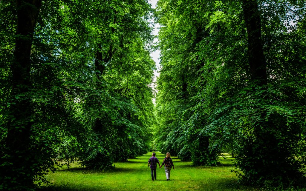
Westonbirt Arboretum makes for a fabulous day out but is on the pricey side. If you check your map however, you’ll notice a convenient national trail, the Macmillan Way, splicing through the woods. This can be done as part of a nice circular route, and while I would suggest you don’t take too many liberties, it is a great way to get a taste of the arboretum.
You can link Sherston and Leighton if you’re on a mission to soak up as much of the surrounding area as possible. The Monarch’s Way brushes along the top boundary of Westonbirt if you’d rather go round it. This is an interesting national trail, the 625 mile route roughly following the escape route taken by King Charles II in 1651 after his defeat at the Battle of Worcester.
Horsley / Nympsfield
OS Explorer Map: 168 Stroud, Tetbury & Malmesbury
Terrain: Countryside, woodland or ridgeway
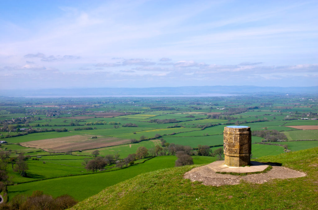
The area between these two villages, and just to the north, is peppered with footpaths, including the Cotswold Way.
Starting with Nympsfield (00 80), a little further north curves the Cotswold Way, following a ridgeline with far-reaching views over the Cotswold lowlands. Look out for long barrows, and Coaley Peak viewpoint. This would make a lovely long walk if you’ve got a full day to spare for exploring.
To the southeast of the ridgeway lies Woodchester Park, a National Trust holding described as a “beautiful secluded wooded valley”. The park is open dawn to dusk and access is via a carpark situated at the west end. Paths are rough with varying gradients, though it can be steep in places. My advice is to take your hiking boots to protect against a pesky (and painful) rolled ankle. It’s also worth noting that there is no mobile phone signal here, so your map is a must! For more information, you can check out the NT website.
Between Nympsfield and Horsley is a whole host of different trails, perfect for any timescale. This is a hilly area, so if you’d rather get some cardio into your hike, then this is for you. You could even start from Horsley and head across to the pub in Nympsfield, before returning. By my reckoning that’s a nice 8km-ish hike. Or do it the other way round and end up in the pub, because there’s no harm in supporting good old local British businesses… which is my excuse at least!
West –
Western Gloucestershire is one of my favourite places in the world! Yep, you heard me right. This gorgeous area, bordered to the west by Wales, is a mere hour away from my home and the perfect place for solo hiking daytrips. Don’t just take it from me: the Wye Valley is the birthplace of modern tourism.
The Forest of Dean
OS Explorer Map: OL14 Wye Valley & Forest of Dean
Terrain: Woodland
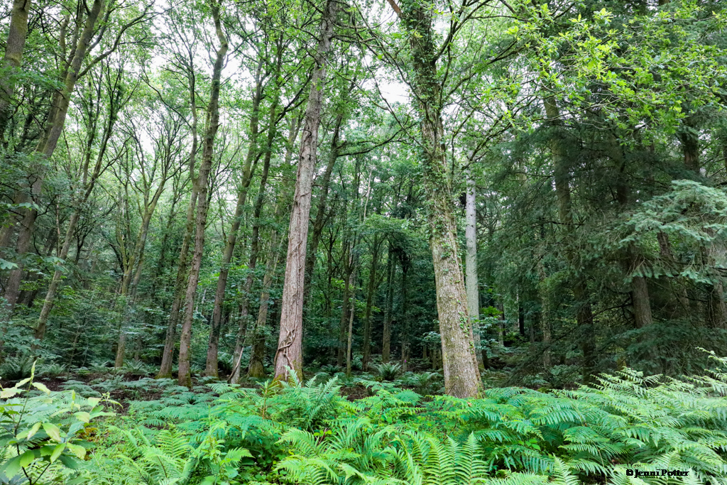
A well-maintained woodland that still feels wild enough for the untamed among us, the Forest of Dean is situated on the west side of the River Severn. With signposted paths, for both walking and cycling, this is a great place for solo hiking. There tends to be people around if that makes you more comfortable, though you can still enjoy a quiet, peaceful walk or hike in the woods (unless the school trips are there!)
You can find loads of carparks scattered throughout the woods, though some you have to pay for. Make sure you’ve either got change in the form of pound coins, or download the RingGo app before your trip, as the signal can be patchy once you’re there.
The popular sculpture trail is a great addition to your route, taking in 4.5 miles of outdoor art. It’s well signposted, with handy short cuts if your parking ticket is running out (I take too many photos!) I managed to miss the cathedral sculpture, which is the reason I wanted to go. I ended up having a lot of fun though, and now I’ve got a good excuse to return!
Would I recommend a map? Yes, just in case. Unless your sense of direction is pretty spot on, getting lost in a woodland is never fun.
Top AWW Tip: Look out for wild boar! Obviously keep your distance, as these are wild animals, but in my experience they tend to be incredibly wary of humans… so good luck spotting one!
Symonds Yat Rock
OS Explorer MAP: OL14 Wye Valley & Forest of Dean
Terrain: Woodland
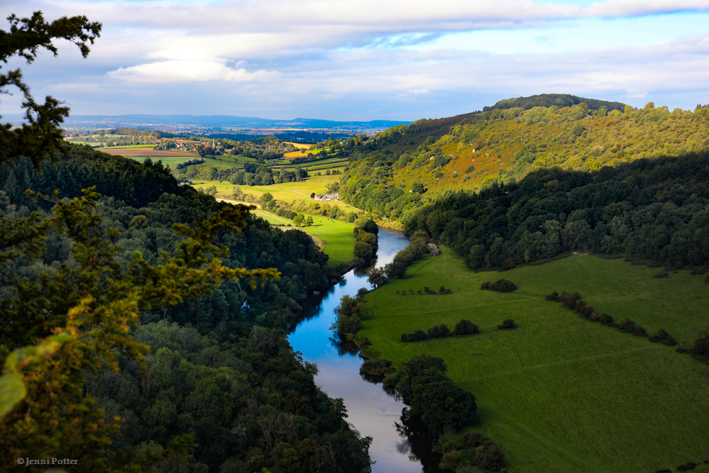
Symonds Yat Rock is a popular hiking area, with a fabulous viewpoint to either start or end your trip with. It’s a personal favourite spot of mine, in spite of it usually being fairly busy. There’s nothing like being up high with amazing views!
With a huge carpark (you have to pay I’m afraid), free toilets and a café for snacks, this is a slightly less off-the-beaten track area, but a hiking choice I stand by 100%. Yat Rock itself provides views over the River Wye and is a great place for spotting birds of prey.
The area has various different hikes, clearly marked on maps and around the trails. Pick the level of difficulty and length of time you’re comfortable with and off you go! The routes range from 1.2 miles (2km) to 11 miles (17km).
Having travelled here before as a solo hiker, depending on when you go, you still get the isolation you may crave, whilst staying safe and knowing there are people nearby. I’m not the biggest fan of solo hikes in forests, but I love it here because it is well maintained. Perhaps this area may be a little too ‘sanitised’ for your sensibilities, but I would say definitely give it a go before you decide. It’s worth it for the views alone (and the toilets!)
Symonds Yat East
OS Explorer MAP: OL14 Wye Valley & Forest of Dean
Terrain: Woodland
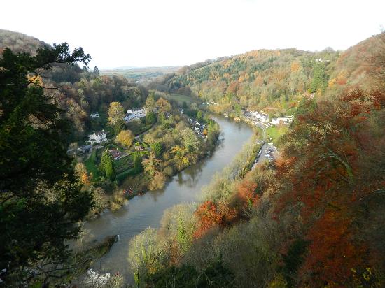
Symonds Yat East, which is situated below the Rock, is usually packed because it’s very small. There’s a fabulous pub right on the riverside, and a nice flat walk along the Wye if you’re looking for a trek before the pub, or a gentle wander after it. This place gets as busy as the Rock above, so expect to have to wait for a table at the pub.
Hikes here follow the run of the river. My advice is to hike to the footbridge on the south side of the river, then back along the north to catch the ferry and hop across the river back to the pub. Bear in mind that it’s been out of action during covid, so check the board at the launch by the pub before you commit.
Oh, and if you fancy hiring a canoe or kayak this is the place to do it! Just watch out for the little rapids downstream if this is your 1st trip.
Top AWW Tip: Make sure you have change for the carparks, or download the parking app RingGo first – the signal is patchy there at best!
Offa’s Dyke Footpath
OS Explorer MAP: OL14 Wye Valley & Forest of Dean
Terrain: Varied
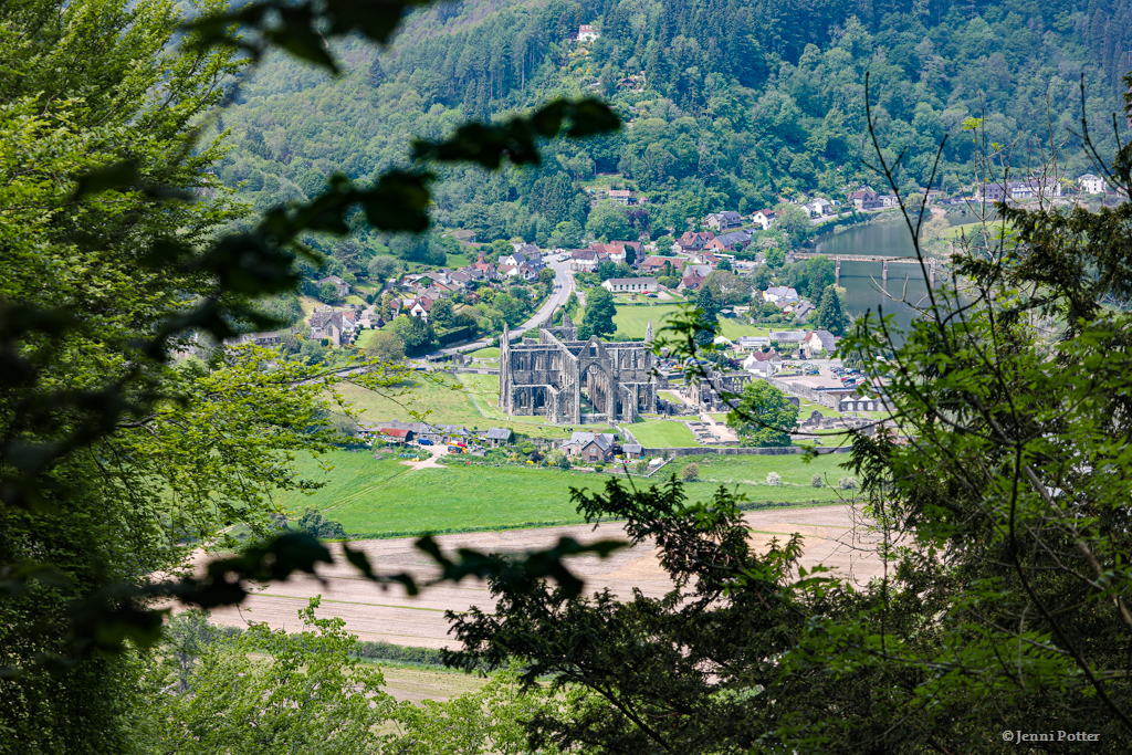
This spectacular footpath is named after the dyke (ditch) that King Offa ordered to be built in the 8th century, most likely to separate his Kingdom of Mercia from rival kingdoms in the country we now call Wales.
The trail itself opened in 1971 and crosses the English/Welsh border no less than 20 times. The 285km route takes 14 days to trek in one go, starting at Sedbury Cliffs on the Severen Estuary in Gloucestershire. While it passes through many counties, both English and Welsh alike, make the most of starting the route from Gloucestershire.
I’ve hiked along and near sections of this National Trail, and I’m looking forward to eventually completing the entire route one day. It takes hikers 12 days, and I’m yet to decide whether to do it in one fell swoop. This year, 2021 marks the 50th anniversary of the trail, so what are you waiting for? Grab those boots and let’s go!
AWW Tip: Check out the Devil’s Pulpit overlooking the famous Tintern Abbey. Legend has it that the devil preached from this rock to try and persuade the monks below to abandon their order.
The Cotswold Way
OS Explorer Maps:
- 155 Bristol & Bath
- 167 Thornbury, Dursley & Yate
- 168 Stroud, Tetbury & Malmesbury
- 179 Gloucester, Cheltenham & Stroud
- OL45 The Cotswolds
Terrain: Varied
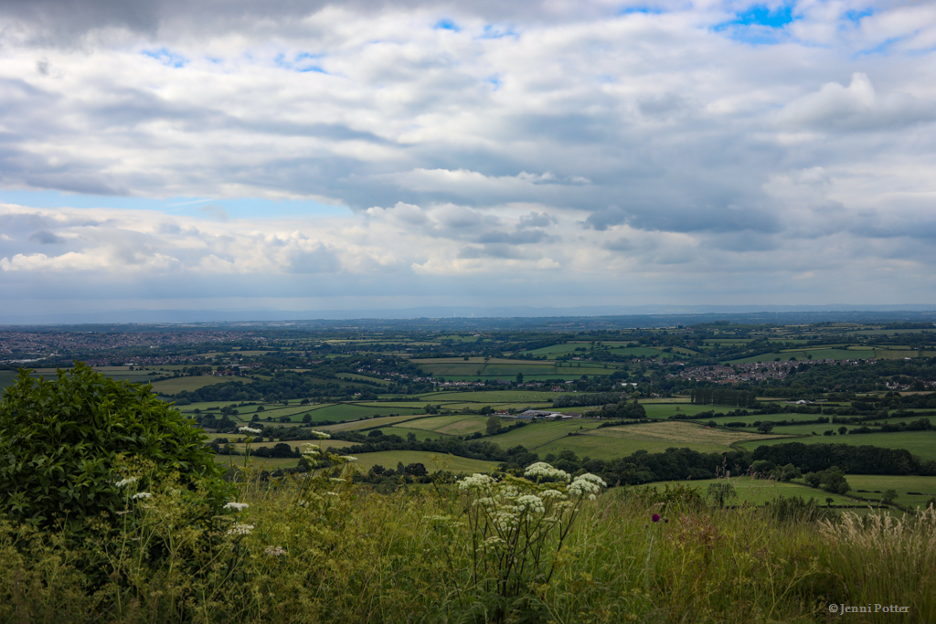
What article on hiking in Gloucestershire would be complete without mentioning the famed Cotswold Way. This national trail, starting from Chipping Camden in north Gloucestershire and finishing in Bath, north Somerset, takes in some of the best scenery of the southwest.
You could opt for a hiking holiday along this route, or pick and choose the sections you want to do in stages. Beware the frequency of steep climbs in this part of the country though – don’t expect a nice, gentle yomp! That being said, don’t let the rolling hills stop you; I find that a hike such as this is one of the most rewarding.
While I’ve hiked sections of this route, I’ve long wanted to do this from start to finish. Will I do it all in one go, or in sections? I guess you’ll just have to stick around and find out! Apparently the 164km (102 mile) route takes 7 – 10 days to complete.
AWW Tip: Check out the exhaustive National Trail site about the Cotswold Way route to plan your trip. While there are many tour companies offering to sort everything out for you, there is no need to pay premiums since you can easily organise this as a backpacking adventure or as multiple day trips. Check out the National Trail site, full of all the info you’ll need for planning your self-guided trip.

Go Hiking in Gloucestershire
Gloucestershire is a gorgeous part of the country to explore and I cannot recommend it enough. Whether you live in or near the county, or are looking for your next hiking holiday or expedition, then this is a great introduction to what the southwest can offer.
Which part of Gloucestershire would you most like to hike in? Will you be going solo, or teaming up with some intrepid friends? Let me know in the comments below!
Alternatively, if you’re looking for some hiking tips and tricks, check out my beginner’s guide to hiking!
Until next time fellow wild wanderers,
Jenni
👣